Google Earth
TGA US Coverage


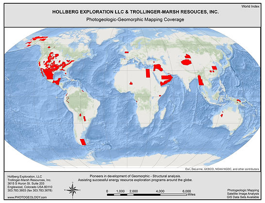
TMR / Hollberg / TGA Photogeologic Mapping
The domestic map library of non-exclusive detailed photogeologic-geomorphic mapping encompasses more than 750,000 square miles within the United States. Most of these studies were accomplished by the use of special purpose cameras and are considered to be the most comprehensive and detailed surface studies ever made of the subject area. This mapping is available for purchase for less than one-fourth the original cost to perform the work.
Standard deliverables can include:
-
Color & B&W Geo-referenced images (tiff images), on flash drive, (Projection to be specified by client).
-
TGA Geologic report (including discussions on Methods of Interpretation and, Structural and Geomorphic Features of Prime Significance on flash).
It is understood that any Hollberg / TMR coverage will be provided to under a license agreement.
Hardcopy prints are also available.
Google Earth
TGA World Coverage